List of Methods Water Quality Data

Assessment of a watershed’s biological condition provides the detailed information needed to identify the sources and impacts of stressors. It allows the mapping of impaired waters, and perhaps more importantly, it provides a guide to the least stressed areas in the watershed where watershed ecosystems should be most intact. It enables the prioritization of conservation and restoration efforts, and forms the basis for effective advocacy. With sufficient data, it allows the development of long term trend information and can provide quantitative information about the effectiveness of protection and restoration programs, as well as warning of new degradation.
Our assessment program collects many types of data and then integrates that data into GIS (Geographic Information Systems). Types of data are chosen based on how well they correlate with biological condition.
- In the stream: Chemical and Microbiological Water Quality Data
- In the stream: Macroinvertebrate Indexes of Biotic Integrity (IBIs).
- In and along the stream: Habitat Assessments (HAs)
- Along the stream and throughout the watershed: Land Cover
Using GIS is the most effective way to organize and view all the data available about a watershed. It is also the most effective way to carry out planning, convey vital watershed information to the public, and show the need for projects and funding.
Chemical and Microbiological Water Quality Data
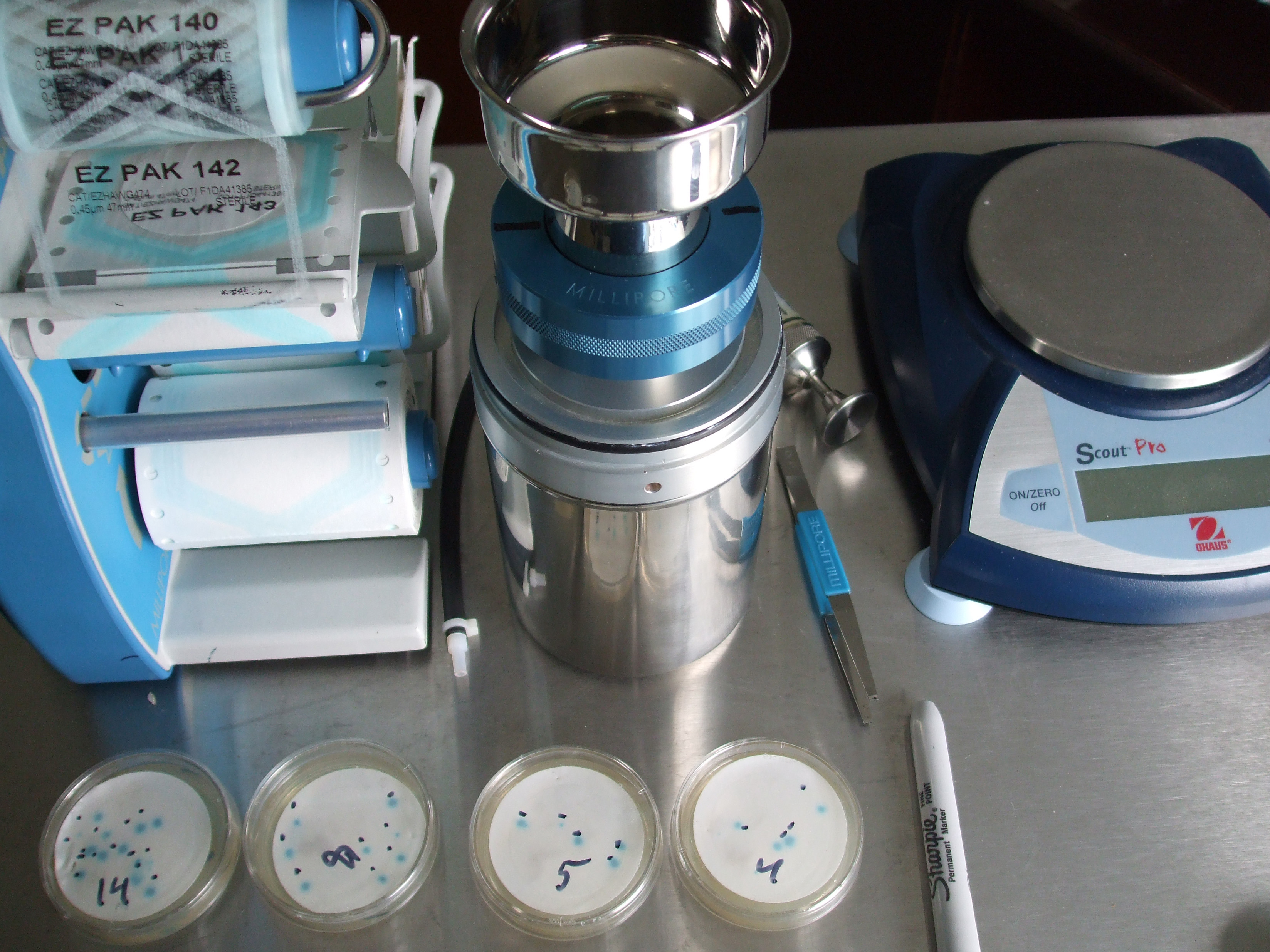
Water samples from a stream are analyzed for a variety of parameters. These samples yield a “snapshot” of the water quality when the sample was taken.
Historical Data: The USGS, Pennsylvania Department of Environmental Protection (DEP), and other organizations have been sampling and testing in our watersheds since the 1960s. GVWA has been collecting, organizing, and processing this data to establish baselines and identify trends.
New Data: GVWA is sampling and analyzing for a variety of parameters including E. coli, pH, dissolved oxygen, conductivity, nitrate, ammonia and chlorides.
How good does the data need to be? In order to compare and merge data from different organizations and across decades, the accuracy and precision for all data needs to be fairly good. This is accomplished through an established Quality Assurance/Quality Control (QA/QC) plan. At a bare minimum, QA/QC requires the following: an approved method appropriate for surface waters; analytical instruments capable of the required precision and accuracy; trained samplers and analysts; certified reagents, calibration standards and other consumables used; and QC checks during sampling and analysis.
Macroinvertebrate Index of Biological Integrity (IBI)
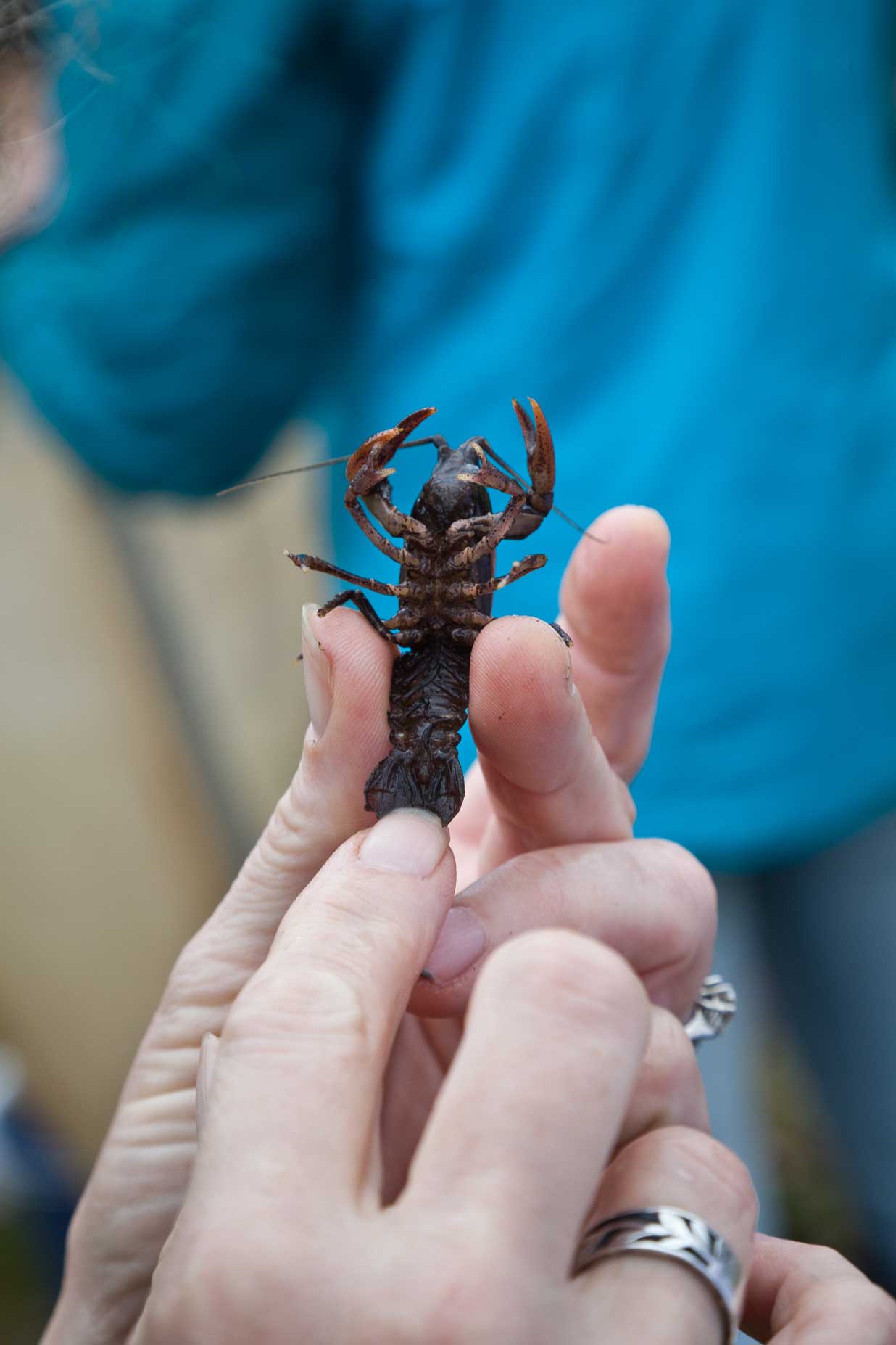
IBIs are excellent indicators of long-term water quality conditions. Because the aquatic animals are continuously exposed and affected by water quality, they become a living record of the health of the stream. Taking samples of freshwater invertebrates and identifying the organisms present can reveal whether a body of water is healthy or ill, and the likely cause of the problem if one exists, much like an examination by a physician. [1]
Different organizations have carried out macroinvertebrate sampling and calculated macroinvertebrates scores; however, scoring systems vary from organization to organization and are not readily comparable. GVWA is collecting the raw macroinvertebrate counts and applying a single Index of Biotic Integrity (IBI) scoring process to identify baselines and trends. From these raw macros counts, we are also creating a short list of local macroinvertebrate species with pictures as an aid to the rapid and accurate identification macros collected in new sampling efforts.
Habitat Assessment (HA)
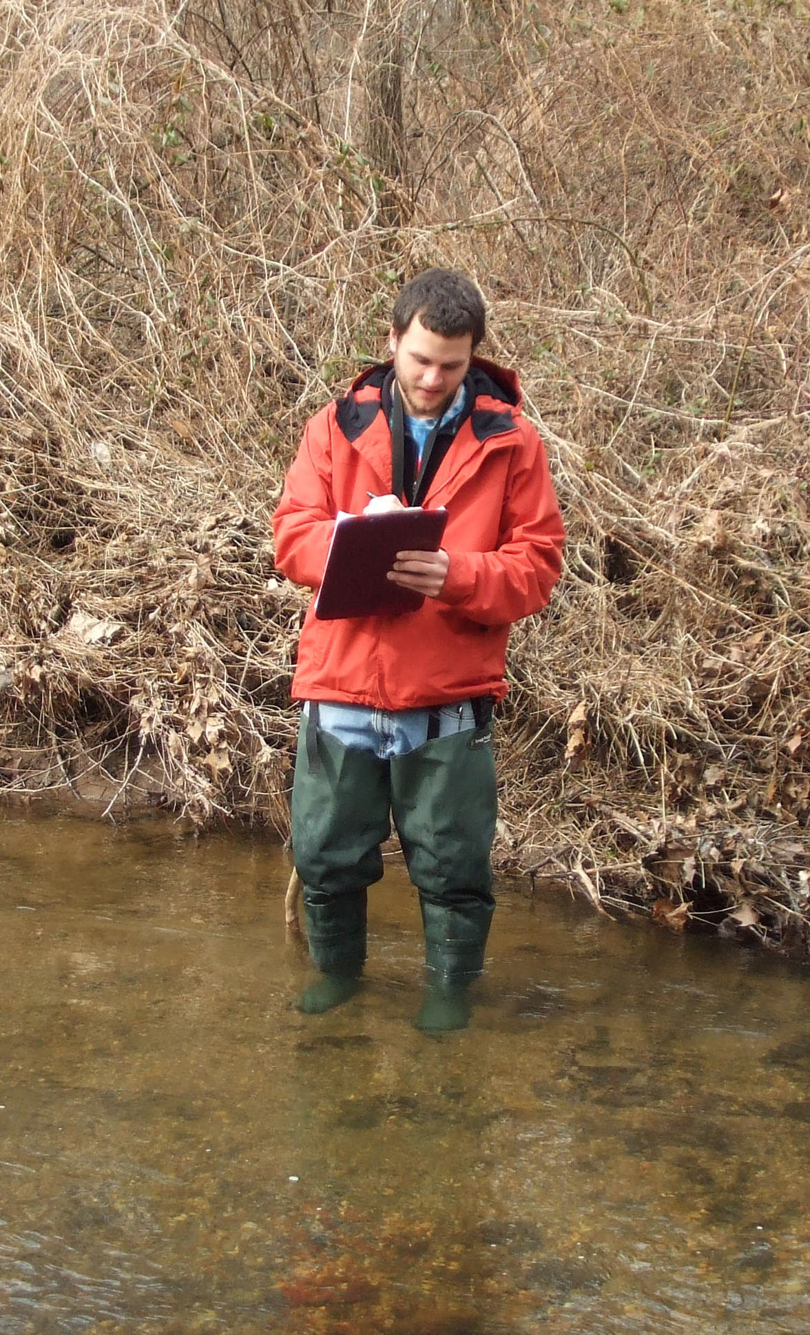
HAs are conducted by visually inspecting and documenting the physical condition of the stream habitat along a 100-meter section of stream. As can be seen in the figure, HAs correlate very well with macroinvertebrate IBIs, and therefore are a very useful tool to complement macroinvertebrate IBIs. Twelve parameters are assessed, each on a scale of 1 to 20, and then totaled. Streams which are healthy and unstressed will score very well, while streams which are impacted from stormwater, construction run-off, loss of riparian buffer, or other man-made stressors will have visible changes which will be reflected in a lower score.
GVWA is proceeding with habitat assessments across three watersheds, using college interns and organization partnerships to greatly expand our capabilities.
Land Cover
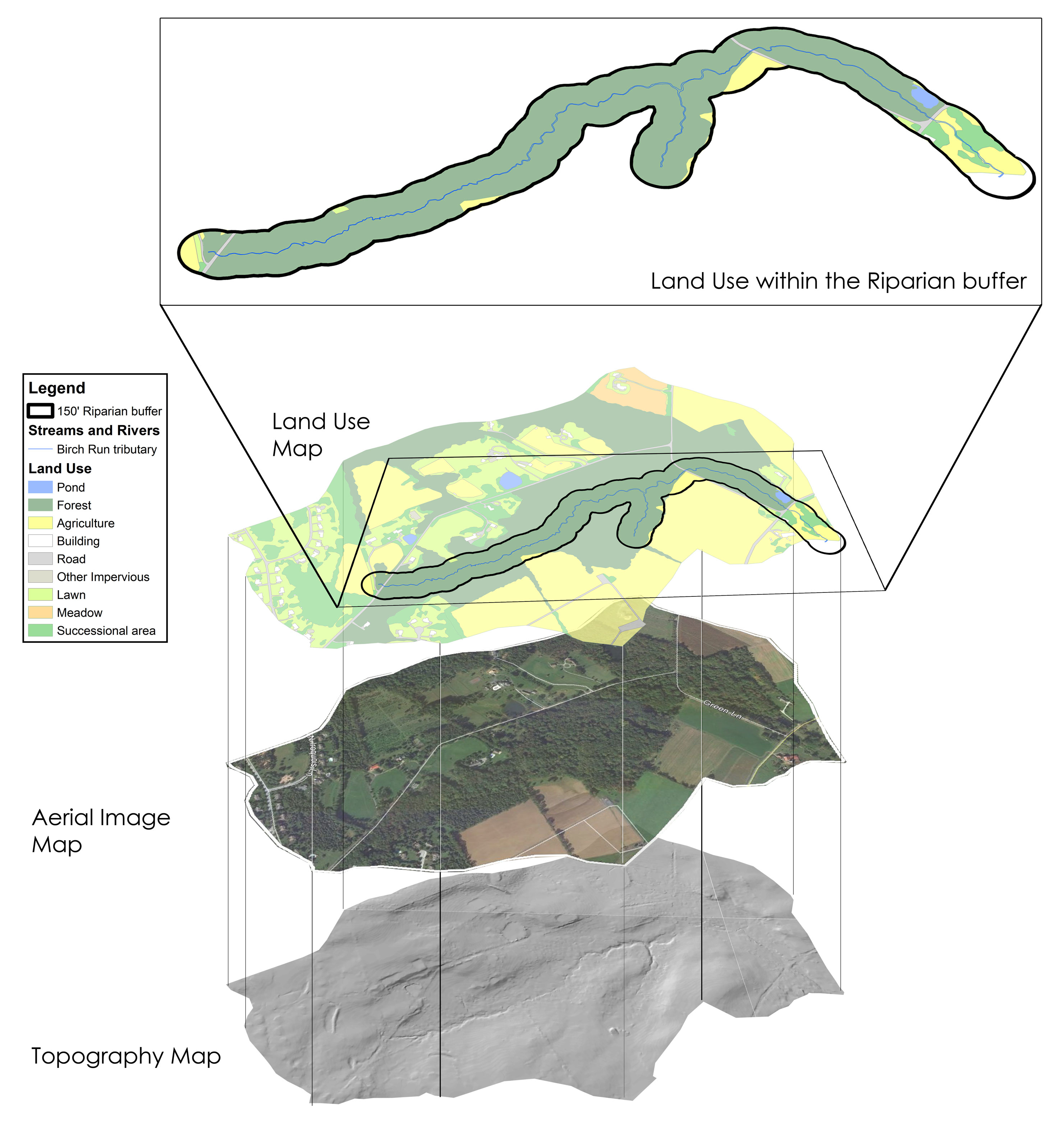
How the land is used in each subwatershed will in most cases determine water quality and the biological integrity of the ecosystems. There are exceptions. For instance, a fully-forested, pristine subwatershed can be subject to a point source such as acid mine drainage or untreated effluent and have terrible water quality. Acid rain from coal plants can have the same effect. But these are rare exceptions.
GIS provides many sources of information about both current and historical land cover. Aerial photography can be delineated by hand in GIS (see example) and there are several other products including satellite land cover data sets with which GVWA has been working for the last two years.
The importance of trees in maintaining watershed health cannot be over emphasized. Higher levels of forest cover in a watershed correlate strongly with water quality. Also of importance is whether those trees are located along the stream, i.e. are there gaps in the forested riparian buffer?
Integrating the Data
Across the country there are many approaches being taken as to the kinds of data being gathered and how they are integrated. The overall trend is to integrate data from many sources to build a detailed assessment of the current health of a watershed. The same process will allow us to use historical data to assess previous watershed conditions and also do scenarios looking forward.
- [1] J. Reese Voshell Jr., A Guide to Common Freshwater Macroinvertebrates of North America